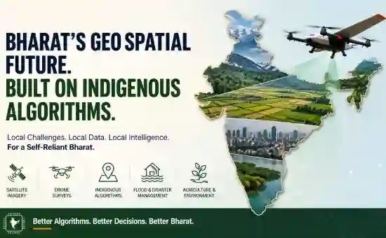
1. Drone Mapping and UAV Orthomosaicking
Bharat's drone industry grew 300% in registered fleet size between 2021 and 2025. State governments from Telangana to Assam are running large-scale drone-based land surveys under the SVAMITVA scheme, which aims to map every rural habitation in the country.
Photogrammetric pipeline for drone orthomosaicking involves structure-from-motion reconstruction, dense point-cloud generation, mesh building, and orthorectification. Every step of this pipeline has a hidden India-specific problem:
● Feature matching algorithms trained on Western architecture and vegetation types exhibit reduced tie-point density over Indian mud-wall construction, terracotta roof tile patterns, and tropical vegetation.
● Radiometric calibration panels calibrated for temperate light conditions introduce systematic colour shifts under India's high solar elevation angle and high-Aerosol Optical Depth summer haze.
● DGCA-mandated metadata - operator registration, drone serial, No-Permission-No-Takeoff zone flags - is not natively supported in any major open-source stitching software including OpenDroneMap.
● Ground sampling distance requirements vary by the Survey of India's prescribed scales, which do not align with the resolution presets in most commercial drone software.
An indigenous drone orthomosaicking pipeline would embed DGCA compliance, carry Bharat-specific lens distortion profiles for the most common drones deployed in government surveys, and integrate with the National Spatial Data Infrastructure's coordinate reference system without manual coordinate transformation.
2. Satellite Image Stitching and Mosaicking
ISRO's Resourcesat-2A carries the LISS-III and LISS-IV sensors producing 5.8-metre and 23.5-metre resolution imagery over the full Indian landmass on a 24-day revisit cycle. Sentinel-2 adds 10-metre resolution with a 5-day revisit. The EOS-04 (RISAT-1A) synthetic aperture radar platform provides all-weather, day-night coverage.
Stitching cloud-free annual composites from these sources requires:
● Cloud and cloud-shadow masking algorithms tuned to Indian cloud morphology - the deep convective towers of the Bay of Bengal monsoon branch are spectrally distinct from stratocumulus over the North Sea.
● Bidirectional reflectance distribution function correction calibrated for Indian vegetation types, since the Bidirectional Reflectance Distribution Function model coefficients shipped with standard MODIS products are derived from global mean spectra that underweight India's dry deciduous and thorn-scrub biomes.
● Radiometric normalisation across the Cartosat and Resourcesat sensor families, which have subtly different band-pass definitions not captured in generic cross-calibration tools.
● Temporal compositing logic aware of the agricultural calendar - a median composite that ignores the kharif harvest season in October will systematically misclassify cropland.
Building an Bharat-specific compositing engine on top of ISRO's Bhuvan platform - or as a cloud-native service on ISRO's proposed Geospatial Analytics Cloud - is a tractable engineering problem that remains unaddressed.
3. Agricultural Remote Sensing
Agriculture occupies 180 million hectares and the livelihoods of 600 million people. The Ministry of Agriculture's Fasal Bima Yojana crop insurance scheme, the Crop Area Estimation programme, and the PM-KISAN direct benefit transfer all depend on reliable crop mapping. Yet the spectral libraries used in most operational crop classifiers deployed in India are assembled from United States Geological Survey or
Joint Research Centre databases, neither of which includes spectra for pearl millet, sorghum, arhar, groundnut, sugarcane ratoon, or the intricate intercropping systems that dominate Indian smallholdings.
An indigenous agricultural remote sensing algorithm stack would include:
● A national crop spectral library built from in-situ spectra collected across agro-climatic zones.
● A phenology-aware time-series classifier distinguishing kharif (June to November) from rabi (November to April) from zaid (April to June) crops.
● A sub-field boundary delineator calibrated for the mean 0.3-hectare Indian plot size, far smaller than the 50-hectare units for which eCognition and similar tools were designed.
● An on-the-fly anomaly detector that can flag stress signals against location-specific historical baselines rather than global norms.
4. Flood Mapping and Hydrological Routing
India loses an average of 1,600 lives and $3 billion annually to floods. The Brahmaputra and it’s tributaries carry the highest suspended sediment load of any river system on earth, making SAR-based flood extent mapping particularly challenging because sediment plumes and flood water share similar radar backscatter signatures. The Ganga's delta distributaries shift laterally by hundreds of metres between monsoon seasons. The Western Ghats' flashy catchments can transit from normal to record discharge in six hours.
Global flood models such as GloFAS and LISFLOOD are calibrated on gauged European and North American rivers. Their hydraulic roughness parameters, bankfull geometry assumptions, and floodplain connectivity rules do not transfer to India's braided and anastomosing systems. A national hydrological modelling framework would need:
● Multi-thread braided channel routing for Himalayan rivers.
● Monsoon-onset hydraulic geometry updating (channel width-discharge relationships change dramatically as sandy banks erode in early monsoon).
● Dam and barrage operation rule curves encoded for the 5,200 large dams in the national inventory.
● Real-time SAR flood extent assimilation correcting for sediment plume contamination using a locally trained classifier.
5. Urban Mapping and Informal Settlement Detection
India is adding approximately 9 million urban residents per year. By 2030, the urban population will exceed 600 million. A significant fraction of this growth occurs in informal settlements - 65 million people live in notified slums today, and the actual figure including unnotified settlements is considerably higher.
The challenge for geospatial algorithms is that Indian informal settlements have a fundamentally different spatial morphology from the Brazilian favelas or African informal settlements on which most published deep-learning segmentation models are trained. Indian jhuggis are dense, low-rise, and interspersed with pucca structures in ways that confuse roof-material classifiers. Street-level imagery localisation fails because OCR models cannot read Hindi, Tamil, or Odia signage.
An indigenous urban algorithm stack would include a morphology classifier trained on multi-city Indian very-high-resolution imagery, a built-up change detector sensitive to the incremental densification patterns of Indian urban growth, and a multi-script Optical Character Recognition engine for place-name verification.
6. Forest Cover and Carbon Stock Assessment
Bharat's Forest Survey of India publishes biennial assessments of forest cover using IRS satellite data and ground truth. The Forest Survey of India reports are among the
most detailed national forest inventories anywhere, yet the above-ground biomass estimation equations applied to convert canopy height and density metrics into carbon stock figures are overwhelmingly derived from allometric studies conducted in Amazonian rainforests or Central African Congo basin.
India's forests are structurally different - lower canopy, shorter trees, higher proportion of dry deciduous and scrub forest, and significant carbon stored in roots relative to trunks. The error introduced by applying tropical moist-forest allometrics to Indian dry deciduous stands has been estimated at 30 to 45 percent. Given that forest carbon is emerging as a tradeable asset under India's Carbon Credit Trading Scheme, this is not an academic error but a financial one.
7. Coastal and Marine Applications
India's 7,516-kilometre coastline encompasses coral reefs in the Lakshadweep and Andaman seas, the world's largest mangrove ecosystem in the Sundarbans, rocky intertidal platforms along the Konkan coast, and macro-tidal mudflats in the Gulf of Khambhat where tidal range exceeds 12 metres. Standard tidal flat DEM correction algorithms assume a uniform tidal model. In the Gulf of Khambhat, this assumption introduces vertical errors of 2 to 4 metres in intertidal elevation maps - errors that propagate directly into coastal flood inundation models.
A suite of India-specific coastal algorithms would include tidal datum integration using the Survey of India's tide gauge network, mangrove species classification trained on Indian canopy types, and shoreline change detection calibrated for monsoon-driven seasonal variability that can mask long-term erosion signals.
8. LiDAR and 3D Mapping
Airborne LiDAR surveys for infrastructure corridors - national highways, transmission lines, railway alignments - are expanding rapidly as DGCA eases airborne LiDAR
certification. The point cloud processing pipeline for these surveys involves ground filtering, above-ground feature classification, and infrastructure extraction. Indian power transmission infrastructure is built to specifications different from North American or European standards. Tower geometry, sag catenary profiles, and right-of-way clearance rules all differ. No commercial or open-source LiDAR classification library ships with a tower-geometry model trained on Indian 66kV, 132kV, or 400kV lattice tower designs. Crews performing clearance analysis must therefore either manually review flagged points or accept systematic misclassification.
9. Disaster Management and Geohazard Assessment
India faces a particularly complex geohazard mosaic: Himalayan seismicity and slope instability, Peninsular earthquake risk on reactivated Precambrian faults, cyclone-induced storm surge on both coastlines, cloudburst flash floods in the northwest Himalaya, and expanding subsidence in over-exploited aquifer systems in Punjab and Delhi. Each hazard type requires a susceptibility or exposure model, and each model's predictive skill depends critically on how well the underlying geology and soil type are represented.
A Himalayan landslide susceptibility model needs lithological units calibrated against GSI's geological maps, not the Swiss Federal Geological Survey's. A Deccan trap earthquake early-warning system needs attenuation relationships derived from Indian strong-motion records, not the Next Generation Attenuation models built for western North America.
To be continue with Part II, where we architect the solutions: from MonSAR and IndraFlood to DroneIN SDK and DeepSlum, the blueprint for Bharat's indigenous geospatial algorithm stack.